On April 7th, the day before Easter, Kendall, my granddaughter and I dropped off my son, Jeffrey for his 2,100 plus mile hike of the Appalachian Trail (AT) which runs from
Amicalola Falls State Park in Georgia to Kathadin Mtn in Maine.
My goal for this blog is to give the perspective from the family. Mine, as his mom, as well as from his sister Beth, and her nine year-old daughter, Kendall. I needed to find something from a family's view, as we wonder and worry and gleam with pride. But since I haven't yet, and since my greatest therapy is writing, I'm going to start this blog in the hopes that perhaps it may offer some insight to families and AT hikers, whether section or thru, as to what goes on not only on the AT trail but also behind the scenes back at home. And also to offer some facts and info, some personal excitement and anguish, as well as to tell a tale to folks who have known nothing about the Appalachian Trail until now.
Jeff''s expecting to be on the trail four to five months and has been preparing for over 8 months. He carries a 13 weight pack, much smaller than most. Some people try carrying 45 lb. packs but end up tossing a good bit of either gear or food, because the AT Trail is a ridge trail, meaning that it connects mountains and mountain ridges.
The night before, Jeff, Kendall, and I enjoyed a "last supper" at Monterey's, our favorite Mexican restaurant near our house, since he won't be eating hot food for a while.

Then on the three hour drive from Greenville, SC to Amicalola Falls State Park,we stopped close to the park at the most posh Chik-Fil-A I've ever been in. It's in a newly developed upscale section of Dawson and the restaurant was huge and packed, had flowers on each table, servers refilling the tea and was one of the best fast-food experiences we've ever encountered. What a great send off for Jeff - a Chick-Fil-A meal topped with a massive and cheap ice cream cone.
When we reached the entrance, he weighed his pack and signed in as thru-hiker no #801 at the very nice visitor's center. So that means over 800 thru-hikers have started from the Georgia end since March 1st when the trail opens.

We were shocked at how packed the entrance was with day-trippers and picnickers. We had to get in line in our car to pay our $5.00 car parking fee to get into the park and then drive around before finding one of the rare remaining parking places.Lots of families of all nationalities were cooking out, having Easter Egg hunts, playing badminton and hiking. It was bizarre. We only saw two other AT thru-hikers at the visitors center and then when we left, Kendall and I saw a van with three packs on top. The ranger told Jeff, 20 thru hikers had taken off that same day so he's probably already met some of them by now. And with those three signing in about 3:30. that may make about 25 for the day. I had expected a quiet, serious and rather sacred send off and I couldn't quite wrap my head around all the colorful frivolity and activity. We spent time there so at the center so Kendall could enjoy it. They have two great displays of all the wild animals he might meet on the trail, one a daytime display and the other a night time scene. It's informative to be able to gauge the size of the actual as opposed to imagined size of the black bears, wolves, bobcats, foxes etc. prevalent in these woods. The first Mountain,
Springer Mtn. is 3782 ft. high in the Chattahoochee National Forest, not the tallest of the trail, but still a hefty height. He has already reached it, I imagine. She bought an adorable owl purse (Jeff gave her a lifelike stuffed owl from here for Christmas) and she did the machine where you stamped a penny. Kendall made one with the waterfall scene for herself and one for Jeff with the hiker scene.


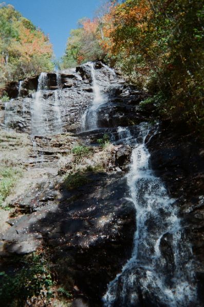
Then we set off on the trail walking through the stone archway, which features the southern terminus - the beginning or ending blue blaze side trail which is described as an arduous 8 mile hike which officially leads to the AT signified by the white blazes on the trees. Jeff wanted us to hike with him on the mile trail to see the majestic Amicalola Falls,which tumble down 729 feet over the mountainside. But unfortunately Kendall was in flip flops and had to walk with her feet stretched out in a Daffy Duck V so as not to slide out of her shoes and go careening in backward somersaults bowling over large families of East Indians, Orientals, Hispanics and Anglo Saxons families causing them in turn to execute backward somersaults, flips and full gainers resulting in avalanche of international proportions. In addition, to put an out of kilter spin on it, she'd had to take Dramamine to survive the road trip due to her tendency to extreme car sickness so, poor thing she was half out of it as well. And she's a city girl, unlike her mom, Beth, (pictured left at age 5 or 6) who I introduced to hiking when she was five.
And then I was even worse. Here I was walking bent in half in what felt like a trail set at a 90 degree angle. My size six feet with 61 years old toes are cursed with arthritis so my Ozzie Osborne shuffle could barely hold up my nonathletic pear-shaped body which has filled out to require larger feet requiring monkey-like dexterity.
No way could I attempt the first first 175 wooden steps, let alone the next 475, heaving chest and hypternsion pounding brow warned me! Although at one time I hiked with Jeff and my daughter Beth separately or us all together in the Blue Ridge Mtns at Oil Camp Creek Road and Jones Gap along Persimmon Ridge every weekend for years in the 80's and 90's. (me back then photo right)
The Amicalola Trail in Dawson County is rated as a
D level hiking trail, on Pam and Randy Golden's, Trail Masters Scale. Difficult - these trails can have steep section with treacherous footing, rock strewn sections, or heavily tree-rooted paths. Yeah, steep sections okay - now add another 475 steps, guys.
 The Goldens have more than 25 years of hiking experience and have a great Internet site on Georgia hiking, with reviews, ratings, photos and directions for each site, plus important info such as visitors center, lodging, picnic areas and trail features such as views, waterfalls etc. For anyone even considering hiking a section or thru hike on the AT, their site will offer a ton of info to help you prepare for the Georgia section, which has been called the third most difficult of the 14 states on the AT after Maine and Massachusetts.
The Amicalola Trail is beautiful trail starting at a reservoir. It runs alongside the Amicalola River with many small waterfalls. But then it suddenly ascends up at a steep angle where I had to walk bent over in half to make it up the incline.
Many AT hikers don't start on this entrance side trail, which they cite as being a really rough hike to start the trail with it's 242 wooden steps perched at a steep angle on the rock face. Instead they get a ride to the top of Springer Mtn
We did get to a plateau where we could take photos and see Jeff off, but Kendall and I only made it about 1/8 of the mile, I'm afraid.

I don't know how Jeff does it, but he's been in training so he will do fine. At Christmas he weighed a slim 180, but bulked up on purpose knowing he'll lose a lot of weight on the hike. A week's worth of his food fits in a shoebox. I'm curious to see if it's enough. It wouldn't be for me, that's for sure, either in diversity or quantity. But I've heard AT hikers are a different breed and Jeff has been in that club ever since his teens. I'm an advocate for the development of the individual to the very core of their existence and the extreme fringes of their capabilities and Jeff is one of those people who comes by such a lifestyle naturally. Or at least he makes it appear that way.
Zach Davis' Inspiration and my personal confession time - So now I must admit, I've been frantic since Jeff left although I was only excited before he left. So to stay sane I read lots of blogs and found one, which while not altogether soothing, is funny, irreverent, honest and psychological.
The Good Badger's Appalachian Blog is what inspired me to start my own blog - as both my personal therapy and a catalog Jeff's experience since he may not get to blog or You Tube. Zach Davis,
author of Appalachian Trials, has a unique psychological approach which got me and I can't wait to receive his book from Amazon.